
Helping turn the prow of our entropyship, the Earth, back upstream so that Earth’s evolving consciousness may explore the vast headwaters of the Universe for billions of years to come.
Cairns of H.O.P.E. #66 – End of the Long Days, 2011
Field Study and Place
Every week, for 15 years, Chrysalis students have gone out on Field Studies. Many wonderful things have happened but it’s always felt uneven. So when I went to visit my mom at the beginning of summer vacation, I started working on a field study curriculum for our teachers. Some of the most powerful field studies are those that respond to a spontaneous happening so I didn’t want a predetermined curriculum. On the other hand, I do want our students to be fluent in many of the patterns that shape the world we live within.
An example is slope (or exposure). Ground slopes towards the nearest drainage. If this direction is towards the south (in the Northern Hemisphere), the ground will be significantly warmer than that which slopes north. Furthermore, the top of the slope will have less soil moisture than at the bottom of the gathering slope. These differences nourish different vegetations. If we don’t understand the underlying patterns, the different colors of green act like disruptive coloration, fracturing the world into a camouflage that renders order invisible. But if we understand that the vegetation is color coding underlying patterns, then the land speaks.
So I started thinking of field studies as a time where children learn to read these patterns. Field studies can be the learning of a second language, the language of this world.
Thinking of patterns as a language reminded me of Christopher Alexander’s masterpiece, A Pattern Language (which I praised in Cairns #52 and #53). He presents pattern solutions to a host of architectural problems that designers encounter over and over again. His solutions aim to increase the quality of “aliveness” a person experiences within the designed space. One of the things I love about his book is that its design is a testimony to the ability of good design to increase the “aliveness” of the reader. Within minutes of opening the book, one is pulled deep into new ways of thinking of the world. I dream of a “pattern language” for field study that could do something similar, pulling students into experiences that help them understand the world. Such experiences would create that “sense of place” many of us see as a counterbalance to our transient culture.
A Phenomenal Place
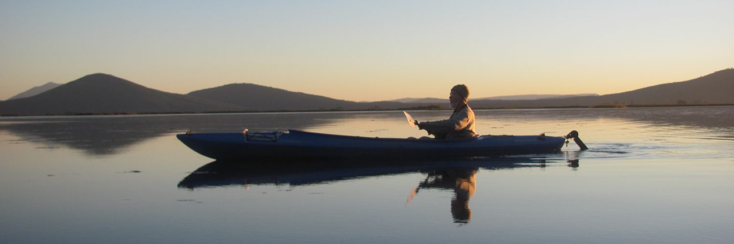
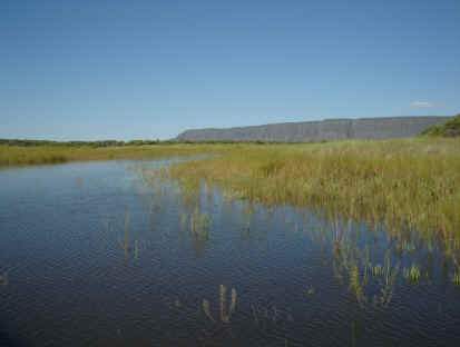
I was driving home through Oregon after visiting my Mom. But since I had my kayak with me, I thought I would take a chance and check out the Warner Wetlands on the way. Southeastern Oregon is full of huge, tilted fault-block mountains with basins at their western bases. During the last Ice Ages, these basins filled with huge lakes. Now these lakes are much reduced or dried up completely. My Oregon Atlas and Gazetteer says of the Warner Wetlands: “Series of interconnected lakes and channels within Warner Valley desert area suitable for canoeists. Cyclical drainage – adequate water levels in lakes and channels will be followed by several years of drought. When abundant levels prevail, complex channel system offers up to 300 miles of routes. Bordered on east by mountain ridge including Hart Mountain (7,648 feet). Suggested canoe route: Winding channel between Turpin and Campbell lakes.”
I twice had checked out the area before but the area had been dry. This spring, however, set records in the western mountains for June 1st snowpack. Because of that, I thought that this surely must be a year when the Warner Wetlands would be full, so I headed off onto the increasingly unpaved roads of south-central Oregon .
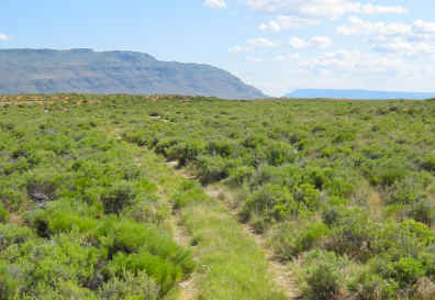
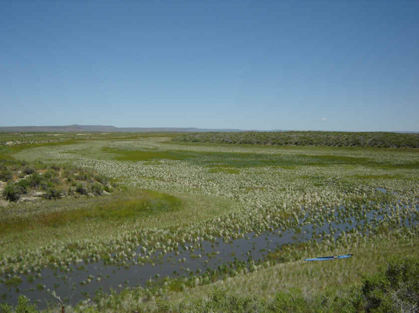
June 28– Along a gravel road in sagebrush high desert reminiscent of Alaskan tundra or Scottish highlands, I met a BLM guy who said Turpin Lake was bone dry, that the wetlands had been dry for several years but that Hart Lake yesterday was spilling, overflowing 1500 cubic feet per second. He directed me to a road that would, he said, take me to the lower end of the water. I would have driven by that “road” without even seeing it – two tracks through sagebrush with foot high sagebrush growing up between the tracks. No tire tread marks. No sign of water – just sagebrush stretching across uneven ground with little relief.
 Midday – Well, here I am. After three miles or so of what feels like a long-abandoned pioneer wagon road, a small lake lies ahead of me.
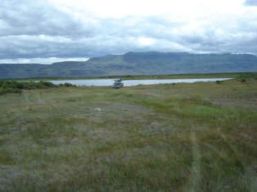
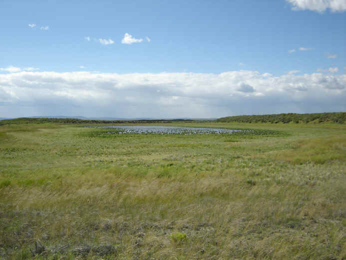
Off to the right, out of view, is a little draw that has a glint of water; probably a small seep. As I get out of the truck, a squalling of gulls draws my attention to a broad shallow valley behind me holding a small remnant of a drying pool. Around the remaining pool grows rings of vegetation like those I’ve seen with drying vernal pools. But my main focus is on the lake ahead of me. I see neither inlet or outlet. The land is a surface of low, rounded wrinkles so there might be an inlet or outlet hidden somewhere along the edge but it is not obvious on first sight. This is not looking promising.
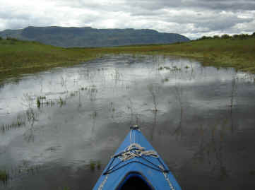
I haul the kayak down to the lake’s shallow-sloping shore, the edge of which is thick with mustard plants that grow out into the water. Water has percolated into the soil about a foot or two beyond the edge of the lake. The dry ground is dusty dry and firm underfoot whereas my foot readily sinks several inches in the darker saturated ground right around the lake. I paddle out into the lake. The water is olive brown; I will be able to see only 4” or so into the water my entire stay.
I paddle along the edge to what I hope will be a channel to something beyond this lake… and there is an inlet, a shallow channel about ten yards wide extending up between two small rises. I stop paddling to see if there is any current flowing into this lake; if there is, it is undetectable amid the “background noise” of breezes.
 I paddle past the two rises and the channel opens to the left into a narrow pond with an obvious inlet up ahead. However, there is also a cove to the right that I decide to check out first.
I paddle to the end of the cove, defined by a two-foot high thicket of mustard plants. But it is not a shore; water is flowing through the mustards. For the first time I am in the presence of a definite current, albeit only a few inches deep. The slope steepens; the channel narrows to two feet; the current increases. I glide through the mustards around a couple of curves towards the right, continuing to drop. The water broadens into another area of thick mustard plants. I paddle through them around another curve and suddenly recognize the land ahead of me as the slope near where my truck is parked. The channel has curved me around to the right back to my starting place. The water becomes too thin and the mustards too thick to go any further but I realize that this flow of water is what I thought was a small seep when I first arrived. I also realize that this twenty foot wide, three inch deep current is flowing towards what I had thought was a drying-up pool. It is a filling-up lake instead. This whole place transforms in an instant into something wondrous – a wetland filling.
I exuberantly turn around and paddle hard (a challenge when the water is only a few inches deep – sometimes I’m poling more than paddling) against the current back up through the mustard to that second narrow lake, and head for its inlet. A narrow, sinuous channel snakes up through mustard plants between small rises until it opens into another pond. I can see this pond’s inlet off to the left but I first explore to the right. Around a point of land the pond opens into an invisible cove. I follow it around and behind a point near the end of the cove is another channel leading off to a small pond.
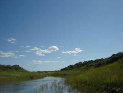
The country is low-lying, rising ten feet or less above the water surface. After 4 or 5 ponds, I come to a ridge that rises 10-15 feet high. I beach among the mustard and walk to the top, capped in sagebrush. I am disappointed at how little this higher perspective reveals. I see no “big picture.” I look down on the ponds, channels, and rises right around me but a hundred yards away, everything appears to blend pretty much into a level, sagebrush-covered land. There is no sense of a land shaped by a drainage system.
I return to my kayak, paddle up the channel about ten yards. The main channel curves sharply to the left but a narrow side channel extends straight ahead.
I paddle that way and the channel drops steeply down into a small pond filling, lined with gulls and willets. I try to imagine this side valley filled with a lake, then paddle with great effort back up the steep drop and continue on up the main channel. The general upstream direction is southeast towards snow-corniced Hart Mountain but the path twists and turns and every channel is unique. As I keep moving upstream, the ponds and channels grow wider. A few deeper ponds have Western Grebes. Many have small flocks of phalaropes. The phalaropes fly in tight groups that all bank at the same time creating a collective whoosh. Sometimes they all drop into the water with a startling, compact suddenness while other times they turn and disappear behind some point of land, revealing the channel to the next pond.
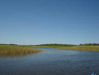
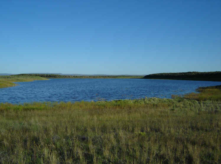
Finally I come onto a really big lake. This is where all this water is flowing from. (According to the map back in the truck, it is Campbell Lake , 4 miles wide.) I turn back. Shortly after leaving the lake, I see a white post off to the right that indicates a canoe route. I paddle down towards the channel to explore but very shortly the water is only an inch thick flowing through thick mustard and I can go no further. So I return to the route I came by and follow the twisting/turning channels and ponds back to my truck.
The first thing I do is photograph what I thought was a drying pool and now realize is a filling lake behind my truck.
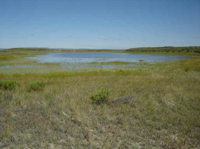
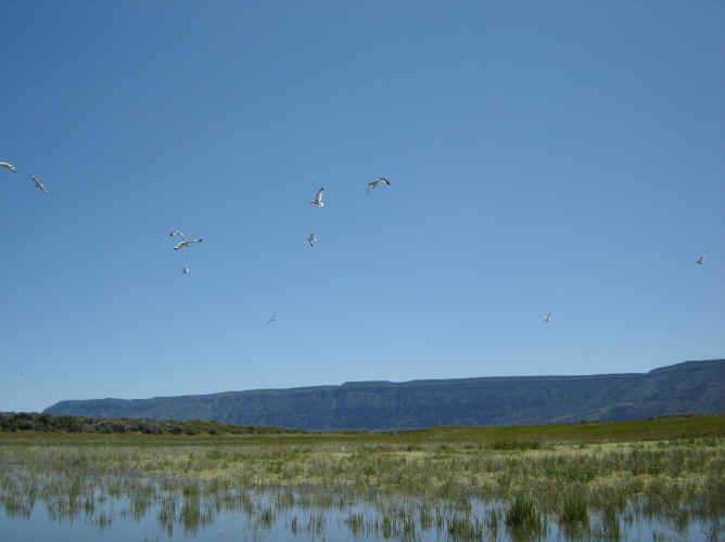
 It is definitely larger than when I arrived so after lunch I walk down to the it. Gulls, avocets, and willets patrol the edges. I can stand by its edge and watch it expand outward a couple of inches per minute. I hypothesize that the gulls (and probably other birds too) are here because the advancing water is flooding all the burrowing insects, spiders, and rodents and the birds are here picking off the fleeing inhabitants of the drowning valley bottom. The gray dusty soil absorbs the water and firm footing turns into mud.
What is this soil? Some is probably volcanic ash from Cascadian eruptions. Some would be sand and silt carried down from the headwaters. But the whole region was lake bottom in Pleistocene times and since then there might also be thousands of generations of decomposing algae and bacteria left behind from each inundation. What is happening chemically when the soil absorbs the water? The clay muds I’m familiar with take days of slow percolation to turn into foot-sinking mud. This stuff turns goopy in seconds.
Down at the other end of the lake, I see two possible outlets if this lake ever fills up. The one to the right terminates in about a hundred yards. The one to the left goes into a dry lake bed and beyond that is a sinuous, mustard-filled valley extending off through the land. I follow it for about half a mile. It keeps going; I turn back. I return to my truck to set up my tent, have dinner, and watch a storm contest with the sunset over the filling lake. A few sprinkles fall. Night comes on. 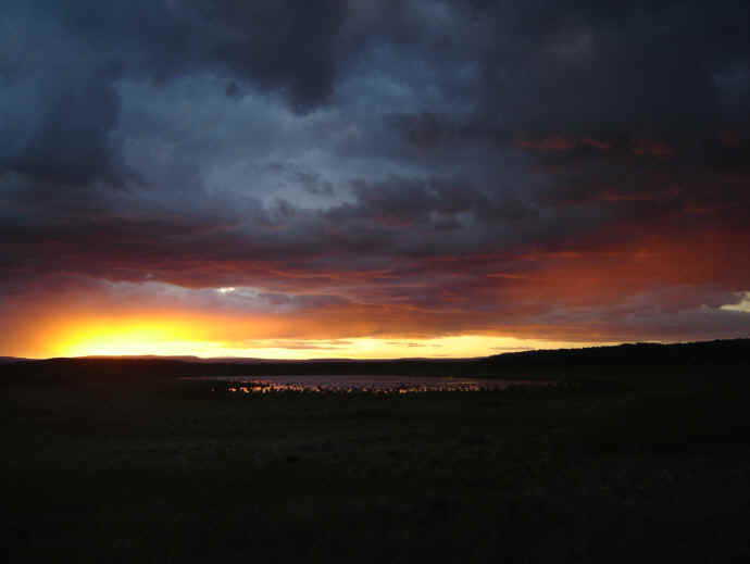
June 29 – The next morning coyotes are yipping. The passing storm cleared the sky. I get up and photograph the filling lake.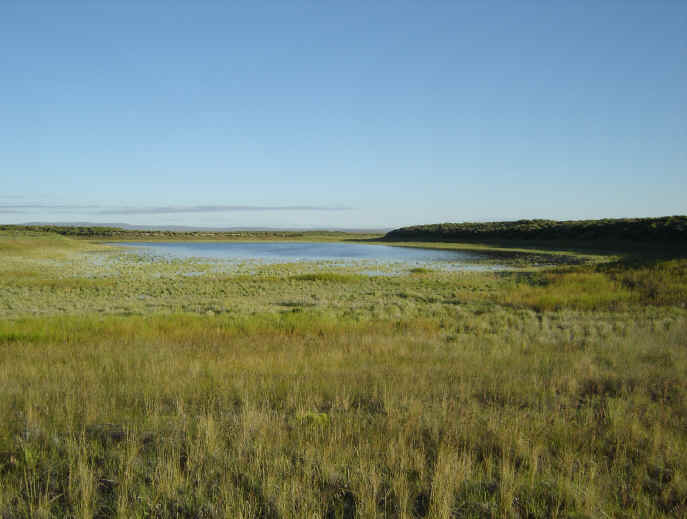
After a quick breakfast, I start off on another adventure. My intention is to quickly paddle back up to Campbell Lake and try to follow that other route down as far as I can. I start up. Things feel different. The ponds are larger. The channels are wider with less current. I come to the side valley that was filling with a lake yesterday afternoon. It has filled. I paddle out into it through slack water and explore its new shoreline. The birds are gone; everything that will be flooded has been flooded. This side valley was receiving some of the overall flow yesterday. Now it is not. The overall flow is pouring into some other place today.
I see my first shovelers, a dabbling duck, along the edges of the ponds. I approach Campbell Lake and turn to explore the new route. More water is now flowing this way so that I can easily kayak through the mustards and down along a new channel. What follows is an utterly pleasurable drift. Ponds connected with channels had been the dominant pattern on my first route. But this route is mostly a slow-moving sinuous channel.
I drift pass meadowlarks fluting from the tops of sagebrush. I come around a corner and see a coyote ahead drinking. The drone of bees is everywhere. Though the water is submerging the mustards, their flowers are still above the surface so that the bees can still pollinate them. I drift literally through a “meadow” of bees buzzing busily all around me. My view keeps changing depending on which direction the channel wanders. Sometimes massive Hart Mountain defines the horizon.
 Other times I gaze out over a vast horizon of blue pierced occasionally with a dust devil’s white column. I see a loggerhead shrike perched on a sagebrush. I remember the bird book saying their habitat is “open country” and I look around and laugh. Yes indeed, this is “open country.” I wonder how many people have ever experienced “open country” like this.
When I drift into a pond, a white post shows where its outlet lies. A rule forms: ‘Take the white post last’ meaning “don’t head towards the white stake when you come into a pond. Yes, you will leave by that way but go the other direction and explore the unknown dimensions of this pond first. Then take the white post last.” Again and again, as I explore each pond, what I think will be the end of the pond turns out, only after I draw within a few feet of it, to have a mustard-camouflaged channel leading into another side pond. I have to go all the way around the pond if I want to discover its true shape and dimension. Each hidden cove is unique, hiding from me in a different way. Sometimes they hide behind a point of land. Sometimes they hide because I see the thick vegetation of the inlet from the side and I don’t realize there is a channel coming through that vegetation until I move around in front of the inlet. All these hidings are intensified because my eyes are low, less than three feet above the water. I lack the perspective of height.
A second rule emerges: “you have to go around the last corner to know if it’s the last corner.” This gets me thinking about “place.” One of the reasons I enjoy adventuring into new places is because each place has its own set of “rules” for getting to know it and getting around within it. Part of the pleasure is feeling these rules grow within one’s awareness, feeling this place become another home wherein one walks comfortably, alert, alive. “May night find you everywhere at home,” wrote Thoreau.
The channel cuts through a low ridge and beyond is a higher ridge (the most substantial landform I’ve seen so far) parallel to it. These parallel ridges form a long valley between them. As it enters this long space, my channel spreads into an alluvial fan of bunch grass. Solid clumps of bunch grass every foot or so create a semi-permeable dam that slows the current and spreads it out. The shape of the fan, the distribution of bunch grass, and the flow of diverging water fit together so wonderfully that it’s impossible to tell which are causes and which are effects. The current on the left side of the fan angles off towards a long “valley” filled with mustard, bunch grass, and lots of gulls around a lake that is starting to fill the lowest part of the valley. The current on the right side of the fan is angling off down towards the other end of the long, narrow valley. The current flowing straight ahead keeps flowing down the fan all the way across the bottom of the basin. There, on the other side of the valley, the water joins with a small flow heading off to the right. I can see a white post at the far end of the right side of the valley so that must be the eventual outlet. But because of “Take the white post last”, I turn to the left and have a totally cool time kayaking on two-inch deep water through bunch grass and mustard plants until I reach the filling lake.
 I beach my kayak and scramble up the high ridge to get my bearings. I beach my kayak and scramble up the high ridge to get my bearings. An “of course-ness” delights me when I see obsidian flakes scattered on its summit. This high point drew others too – to watch for movement of prey within this open country and as they waited, they shaped obsidian into arrowheads. While up there, I notice a small lake in the distance. It appears that the lake below me is overflowing into that distant lake.
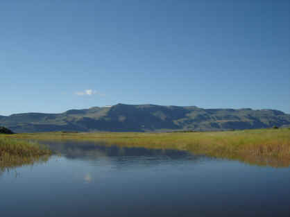
 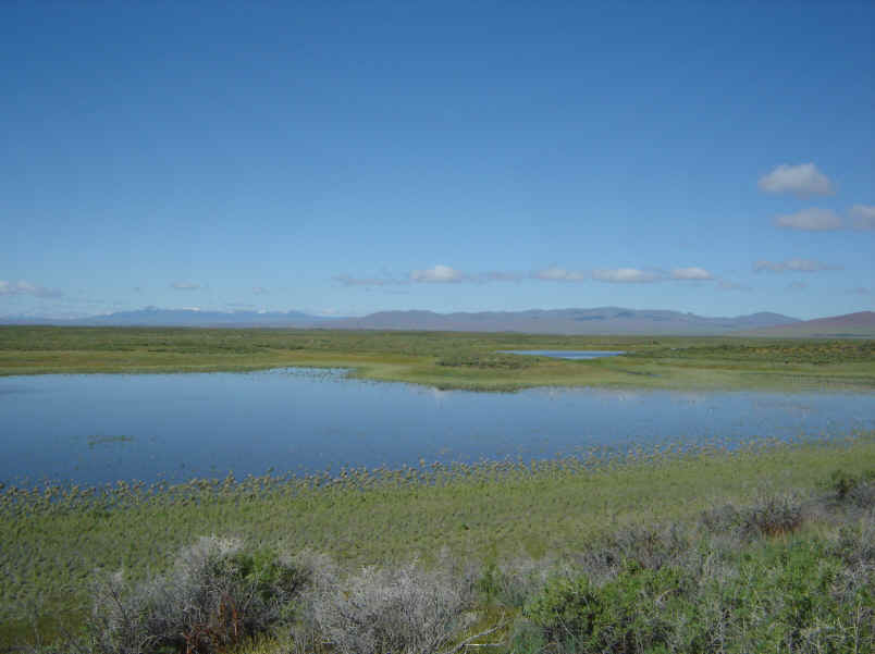 (The distant snow-capped blue mountains to the left are the headwaters, the source of the water flowing into the wetlands.)
So, when I return to my kayak, I paddle over to that outlet to check on that other small lake. I am disoriented to find that it’s not an outlet but an inlet. That distant lake is about five feet higher than this filling lake and the small stream is flowing from that lake down to this lake. This doesn’t make sense. There’s no place for the water to be coming from because when I paddled up to Campbell Lake this morning, I had traversed across all the land that could possibly feed this upper lake and never came upon a place with water flowing out that could lead to this lake with this outlet. Intrigued, I paddle up the stream into that upper lake. A spontaneous whoop of amazement bursts out of me when I see my truck and camp on the edge of the lake. I’ve come full circle. Yesterday, my starting pond had no outlet. The water flowing towards it was flowing into the side channel that was filling the lake behind my camp. But all the water levels in all the channels and ponds are rising by the hour, overflowing new low spots. My lake has filled a bit higher, enough to start overflowing into this lower lake.
Since it’s midday, I paddle over to camp and rest through the heat of the day. I photograph the filling lake and then rest.
 Mid-afternoon, I return to my kayak. I had so enjoyed my morning drift along the sinuous channel that my goal is to paddle back up to Campbell Lake and go down that way again. This time I will turn right at the grass alluvial fan and see if I can follow it to the end of the water.
So I paddle up. As I get near Campbell Lake, I notice that the filling water has flowed into some previously unfilled channels on the south side of the main channel (which is the upslope side of the wetlands). So I go scout the new perimeter. It’s more extensive than I assumed, with more ponds and channels than I think could fill in half a day and with lots of twists and turns. For the second time this day, I feel confused. I beach at a ridge and walk to the top to get my bearings.
I see channels and ponds stretching southwards for at least half a mile. There’s only one way I can make sense of what I see. All this time I’ve been playing around in the overflow from Campbell Lake . But upstream of Campbell Lake are other big lakes – lakes I’ve never seen. Their water levels must have risen high enough to start flowing onto new paths and the same wondrous filling that I’ve been experiencing has been happening a few miles upslope and today the end of that water has reached “my channels” and become part of “my water.” Miles of more channels are opening all around me and more water is flowing into the channels I’ve come to know. Also, it means that I could easily spend the rest of the day following these new channels upstream to other large lakes. But I want to try finding the lower end of the water so I turn back and return to this morning’s channel.
I follow that channel back down along its winding way back to the grassy alluvial fan where this time I turn to the right. From there on I am following a narrow channel down but the afternoon turns to evening. I have to turn back before reaching the end of the water. I make it back to camp at sunset.
June 30 – I awake to an even fuller lake.
 I paddle down to its end and discover that it is now overflowing and filling the next lake bed which I paddle into among the flooding mustard plants. Already this new lake is a few acres large. I return to camp. I am determined today to reach the lower edge of all this flowing water. I go out the new outlet of my lake into the long valley downstream and start on down. So often I am paddling on water a few inches deep. I slide past flocks of gulls resting by the filling water.
 I come upon a coyote crouched, defecating, looking the other way, never seeing me float by. And finally I come to the end of the water. A second bunchgrass alluvial fan descends into a vast curving valley.
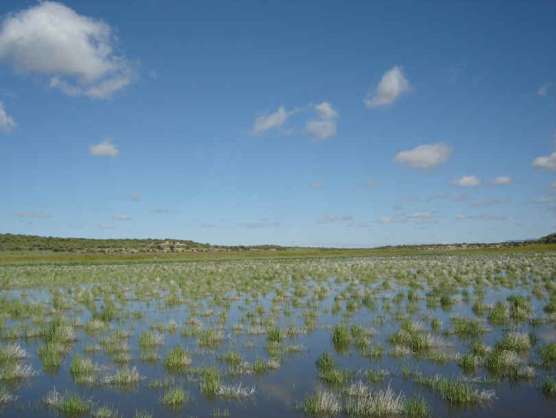
 As the water spreads out over the fan, it thins to unfloatable. I go walking in solitude along the water’s advancing edge. All alone, I write in my pocket notebook, “In the midst of a vast nowhere, I am walking in what is currently, without doubt, the most amazing place on Earth.”
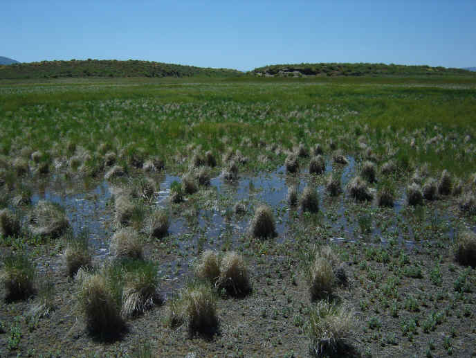 The lower edge of the advancing water
A feeling comes over me, a tantalizing of the mind that has happened only a few times in vast quiet places devoid of humans but redolent with natural processes at work. Its root is a sensed analogy that the synaptical interactions between neurons which give rise to consciousness within our bodies are functionally the same as the complex interactions occurring within this space – the rising water fingering through outlets into new ponds, the gulls following the advancing water, obsidian resting for centuries on ridgetops, ephemeral dust devils whirling upward. All these interactions give rise to a consciousness occurring on a very different scale. Where it dwells I do not know but as I walk along the edge of the advancing water, I am present within a great thought occurring around me.
Back to Cairns of H.O.P.E. page
Just learning how to play with all of this.
Leave a Reply